Loading page…
3D Model
Urban Street Infrastructure Scene Set
by simeon vialva
About this asset
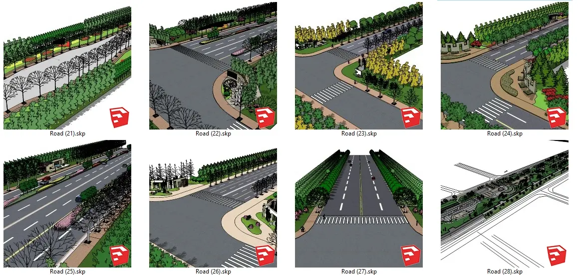
This collection of eight SketchUp road infrastructure scenes provides varied urban street layouts complete with integrated landscaping. The set comprises eight distinct road configurations suitable for large-scale site context modelling. Each model features standard asphalt surfacing, defined lane markings, and pedestrian crossings. The designs incorporate detailed verges and traffic islands populated with diverse tree species and shrubbery, creating a realistic green buffer. The geometries include straight thoroughfares and T-junction intersections, offering flexibility for different site requirements. The inclusion of curbs and paved walkways ensures a complete streetscape appearance. The models are structured to be easily appended to larger masterplan files, maintaining consistent scale and material application across the entire set.
The download is a 302 MB compressed archive containing the native SketchUp (.skp) model holding 8 separate objects. It opens directly in SketchUp; for 3ds Max, Blender or Cinema 4D, import it through a SketchUp importer or convert it first.
When working with these SketchUp models, place them as external components to maintain a clean main project file. Use the 'Replace Component' function if you need to swap specific tree or paving materials to match your project's palette. Ensure the insertion point is aligned with your site's survey datum. These files are useful for establishing environmental context in early-stage conceptual massing or final masterplan visualisations, providing immediate depth and scale to the surrounding site area.