Loading page…
Revit Family
Survey Site Tag
by Cazandra Romano
About this asset
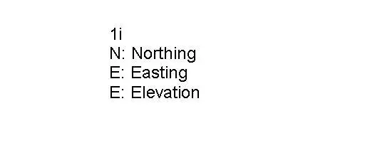
This Revit annotation family provides a clear, standardised site tag for reporting Northing, Easting, and Elevation survey data. The Survey Site Tag is a functional, text-based Revit annotation family designed for site plans and civil documentation. It features a clean, legible layout displaying three primary data fields: Northing (N), Easting (E), and Elevation (E). The text is formatted for high visibility on standard architectural sheet scales, ensuring survey coordinates are easily readable by contractors and engineers. The family is entirely two-dimensional, focusing on technical clarity rather than graphical embellishment, and is intended to be placed directly onto site plan views to communicate precise topographical or geodetic information clearly and consistently across all project documentation.
The download is a 195 KB file containing a Revit family (.rfa). Load it into a project from the Insert tab with Load Family, then place it like any other component of its category; it schedules and tags with the rest of your model.
To implement this tag, load the family into your project and select it from the Annotate tab under Symbol. Once placed on a site plan, the label parameters can be populated manually or linked to shared parameters for automated coordination. Ensure that the text type matches your project standards to maintain consistent documentation. This tag is designed to be placed in plan views and does not require complex rendering or material mapping, making it a lightweight addition to your project files.