Loading page…
HDRI / Environment
Sterkspruit Falls Landscape HDRI Environment Map
by Neeti Kumar
About this asset
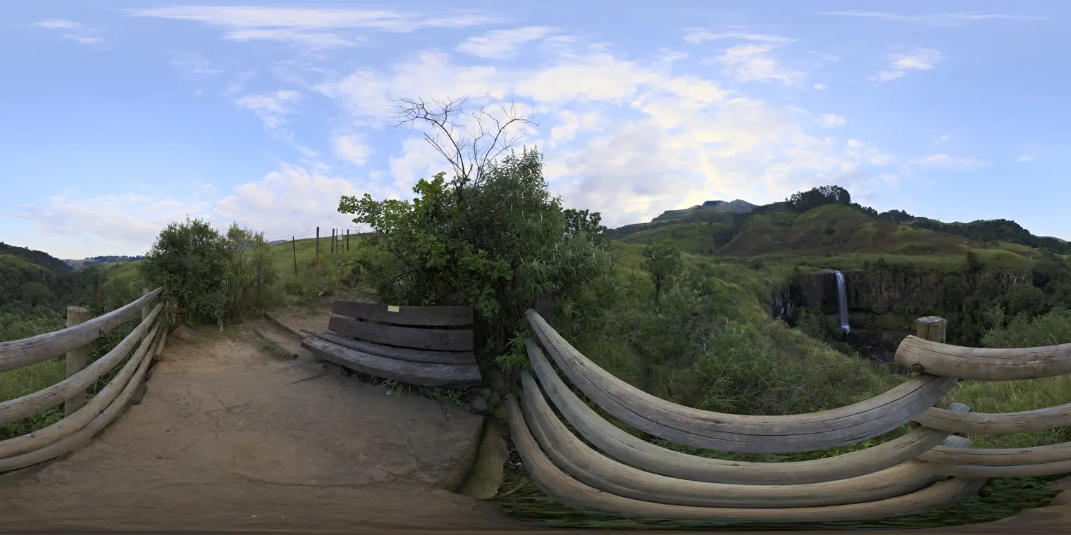
This equirectangular HDRI environment map captures a scenic waterfall viewpoint at Sterkspruit Falls under soft morning light. The environment map features a panoramic 360-degree view from a timber-railed viewing platform overlooking a distant waterfall and rolling hills. The foreground includes a rustic wooden bench and natural earth paths, set against a backdrop of lush green vegetation and mountainous terrain. The lighting is characterized by soft, diffused morning sunlight filtered through a partly cloudy sky, providing low-contrast illumination suitable for balanced exterior rendering. The composition provides a naturalistic setting, offering a realistic perspective of a rugged landscape that integrates seamlessly into outdoor architectural visualisations and environmental projects.
The download is a 6.4 MB file containing a 2K equirectangular high-dynamic-range environment map, ready to load as dome or world lighting in Blender, 3ds Max, SketchUp renderers, Unreal Engine and D5.
Professional users can load this.hdr file directly into the environment or background slot of a renderer. It functions as the primary light source, providing realistic image-based lighting and reflections based on the captured scene. Adjusting the exposure and rotation within the host software allows for precise alignment with the project's camera angle. The file is optimized for quick integration, ensuring accurate colour temperature and global illumination that mimics the soft, natural morning conditions depicted in the panorama.