Loading page…
HDRI / Environment
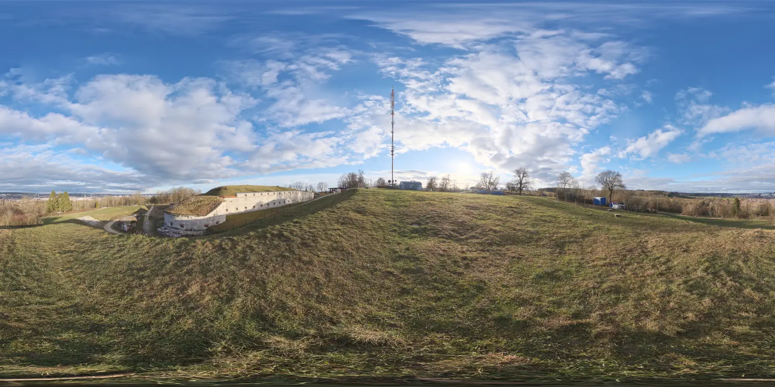
Oberer Kuhberg Rural Field HDRI Environment Map
by JAE IN LEE
About this asset
This rural field HDRI environment map provides realistic natural lighting for architectural renders, featuring a sunny, cloud-dappled sky. Captured at the Oberer Kuhberg site, this high-dynamic-range image depicts an expansive, grassy hillside under a bright, partly cloudy sky. The panorama includes a historic stone fortification structure and a distant communication tower, offering a distinct sense of place. The lighting is crisp and natural, characterised by high contrast between the sunlit foreground and the soft, scattered cloud formations overhead. It is ideal for establishing a believable outdoor context in architectural visualisations, providing both a realistic backdrop and accurate environmental illumination for your 3D assets.
The download is a 6.6 MB file containing a 2K equirectangular high-dynamic-range environment map, ready to load as dome or world lighting in Blender, 3ds Max, SketchUp renderers, Unreal Engine and D5.
To use this equirectangular HDR file, load it directly into your rendering engine's environment slot or world lighting settings. Because it contains full high-dynamic-range data, it will provide both the background imagery and the primary light source for your scene. Adjust the rotation to align the sun position with your preferred shadows, and fine-tune the exposure intensity within your software to balance the scene’s luminance, ensuring consistent highlights and soft shadows on your architectural models.
This environment map is well-suited for exterior visualisations of residential projects, rural developments, or landscape architecture proposals. It pairs effectively with naturalistic 3D vegetation and stone-clad building geometries, helping to ground projects in a realistic, open-air context. Professionals will find this asset useful for mid-day or afternoon lighting scenarios where a clear, bright atmosphere is required to convey a sense of openness and scale. Use it to enhance site-specific studies or to provide high-quality reflections for glazing and metallic surfaces.