Loading page…
Dataset / Training Data
Mountainous Terrain GIS Dataset 004
by Rida Khan
About this asset
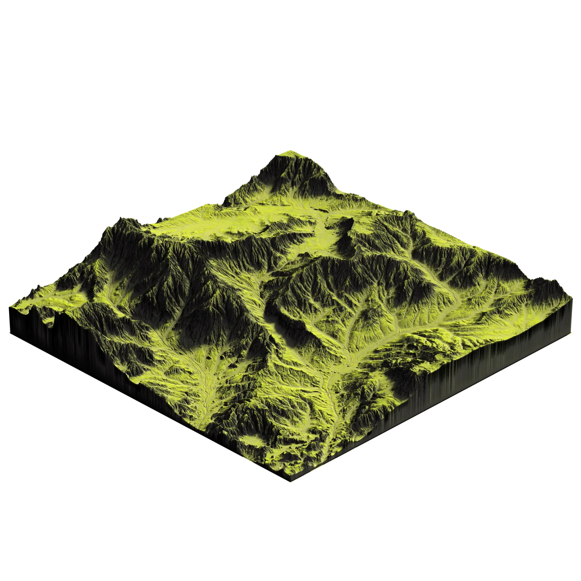
Mountainous terrain dataset providing a 16-bit EXR height map for high-fidelity landscape generation in professional 3D environments. This terrain dataset features a complex, rugged mountainous topography characterized by deep ravines, sharp ridgelines, and varied slopes. The 2K resolution height field provides high-precision elevation data, ensuring realistic geometry when applied to a displacement modifier or landscape generator. Included with the height map are complementary diffuse and soil texture maps, which accurately represent natural surface variations, including grassy plateaus and eroded earth channels. The data structure is optimized for procedural workflows, allowing for consistent scaling and integration into larger site models without sacrificing detail or structural integrity in the final rendering.
The download is a 31.2 MB compressed archive containing .exr files.
Users should load the 16-bit EXR file into a displacement modifier or a dedicated landscape node within their 3D software to generate the physical mesh. Once the geometry is displaced, the accompanying diffuse and soil maps can be layered using a shader network to provide realistic surface coloration. For best results, adjust the displacement strength to match the required project scale, ensuring that the height map remains sharp during close-up camera passes or wide-angle site overviews.
Ideal for landscape architects and urban planners, this dataset is essential for creating realistic site contexts in residential, villa, or large-scale masterplan projects. It serves as a reliable base for site analysis, environmental simulations, and architectural visualizations where natural terrain is required. Professionals often use these assets to establish accurate topography before inserting building models, ensuring seamless integration between the built environment and the natural landscape. It is highly effective for projects requiring detailed, photorealistic outdoor environments and site-specific topography studies.