Loading page…
CAD Drawing
Street Section Drawing Set
by Shelley Yang
About this asset
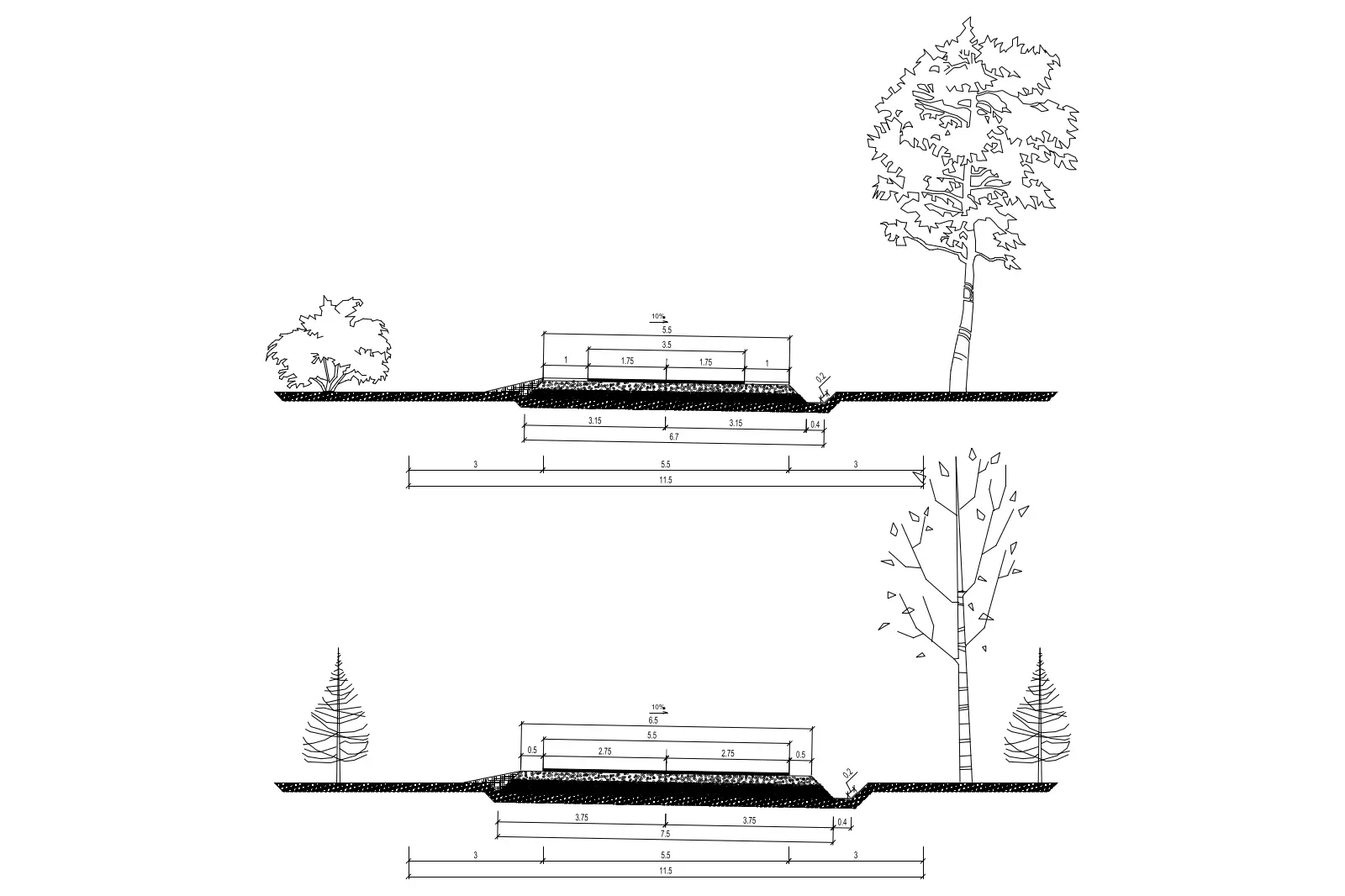
This technical CAD drawing set provides two detailed road cross-sections in AutoCAD format, featuring precise dimensional road profiles. This AutoCAD drawing package contains two distinct street cross-section profiles designed for urban planning and civil engineering documentation. Each section illustrates the structural composition of the road, including surface layers, drainage swales, and total width dimensions. The sections are accompanied by standard vegetation symbols, representing trees and shrubs to provide context for the surrounding landscape. Annotations clearly define the road carriage widths, slopes, and sub-base extents. This file is structured to provide clear, readable geometry suitable for integration into larger site plans, road design documentation, or municipal planning submissions where accurate dimensioning is required.
The download is a 164 KB file containing an AutoCAD drawing (.dwg) drawn in section. It opens in AutoCAD, BricsCAD, DraftSight and other DWG-compatible CAD programs, ready to insert as blocks into plans and elevations.
Professionals can integrate these sections into existing AutoCAD projects by using the copy-paste or block insertion methods. The drawing geometry is clean and organised, allowing users to easily adjust dimensions or modify the road profiles to match specific site requirements. Because the file is provided as native CAD linework, it remains fully editable, enabling designers to swap out vegetation symbols or adjust the annotation text to align with local project standards and graphic conventions.