Loading page…
CAD Drawing
Excavator Operating Range Technical CAD Drawing
by Jonah Klinghoffer
About this asset
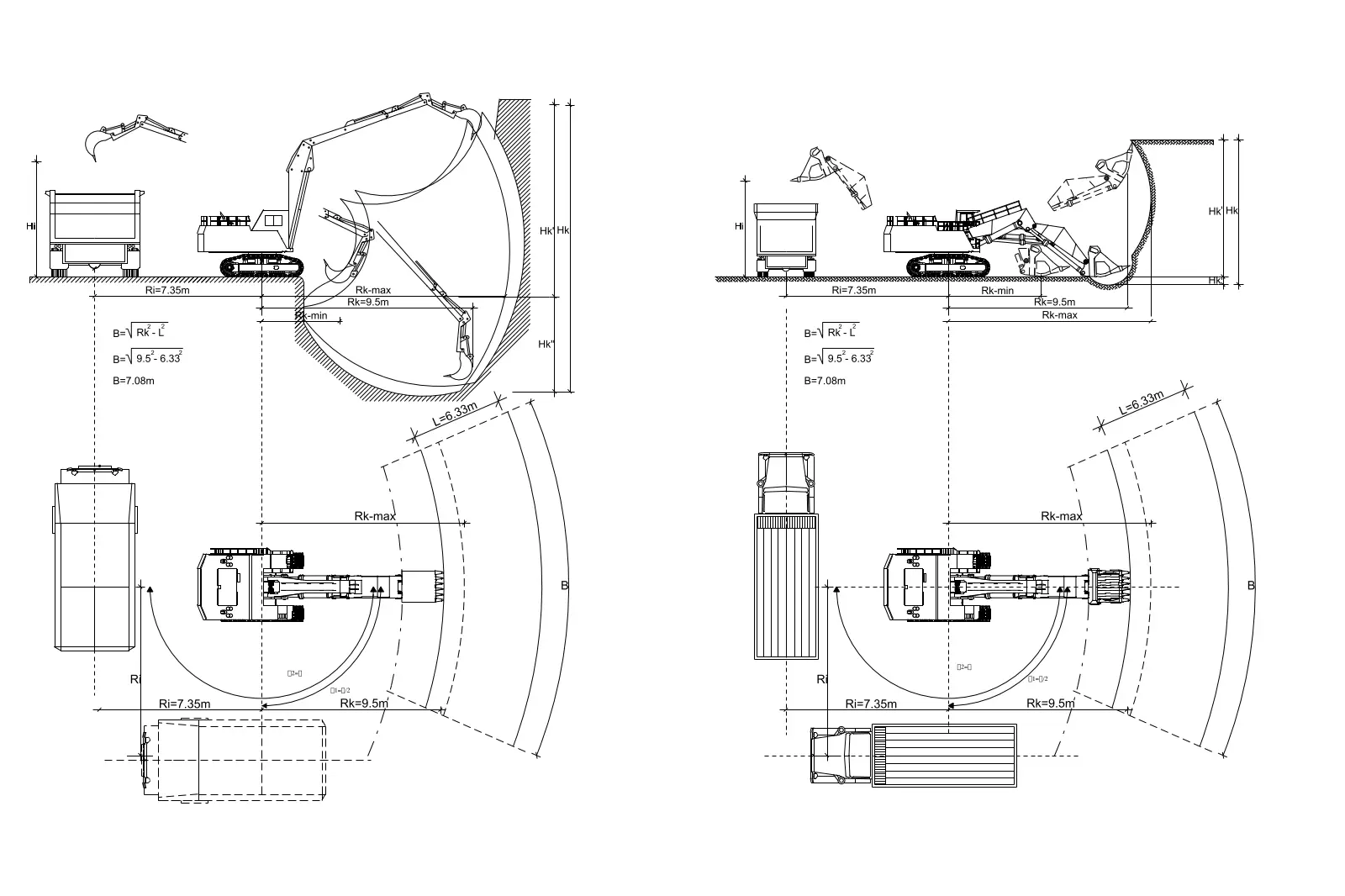
Technical AutoCAD drawing illustrating excavator operating ranges, reach radii, and dump height clearances for site planning. This technical CAD drawing set provides precise geometric data for excavator operations, detailing reach and clearance parameters. The file includes top-down plan views and side elevations for two distinct machine configurations. Each diagram incorporates critical mathematical annotations for maximum and minimum working radii, dump heights, and swing arcs. The linework is clean, standard CAD geometry suitable for defining site excavation boundaries or logistical planning. These diagrams represent the physical constraints of heavy machinery, ensuring accurate spatial analysis for construction site logistics and heavy equipment maneuverability assessments within a larger project master plan.
The download is a 410 KB file containing an AutoCAD drawing (.dwg) drawn in all views. It opens in AutoCAD, BricsCAD, DraftSight and other DWG-compatible CAD programs, ready to insert as blocks into plans and elevations.
Architects and site planners use these AutoCAD blocks to verify spatial requirements during the early stages of site development. The geometry is fully editable, allowing users to scale, rotate, or modify the linework to match specific equipment dimensions. By inserting these blocks into a site plan, professionals can quickly visualize the operational footprint of heavy machinery, helping to prevent conflicts with existing structures or site boundaries during the excavation and construction phases of a project.