Loading page…
CAD Drawing
Coal Mine Industrial Site Layout
by Zev Schwartz
About this asset
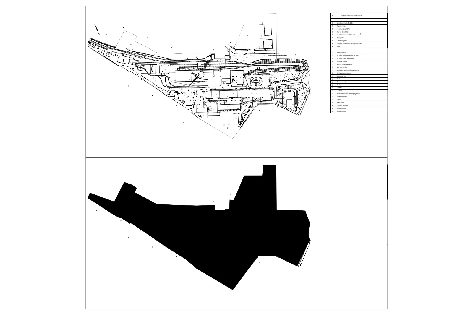
This comprehensive coal mine industrial site layout is provided as an AutoCAD DWG drawing, featuring a detailed plan view and legend. This technical site plan depicts the complex layout of a coal mine facility, including integrated rail infrastructure, various industrial building footprints, and logistical circulation paths. The drawing is presented as a clean, high-contrast line work file, clearly defining the site boundaries and internal zones. An associated legend is included to identify specific operational structures, processing units, and support buildings within the site. The geometry is structured for clarity, allowing users to distinguish between primary transport arteries and secondary service areas. The overall composition provides a clear overview of the site's spatial organisation and operational scale.
The download is a 532 KB file containing an AutoCAD drawing (.dwg) drawn in plan. It opens in AutoCAD, BricsCAD, DraftSight and other DWG-compatible CAD programs, ready to insert as blocks into plans and elevations.
Utilise this DWG file as a foundational reference for industrial site planning or master-planning projects. The geometry is typically organised into logical layers, enabling architects to toggle visibility for site analysis, massing studies, or infrastructure overlays. Users can easily scale the drawing to match specific project site coordinates or reference it into a master model to serve as a base for further design development, site grading, or landscape integration within an AutoCAD environment.