Loading page…
Revit Family
Railway Crossing Turnout
by Sasi Iam
About this asset
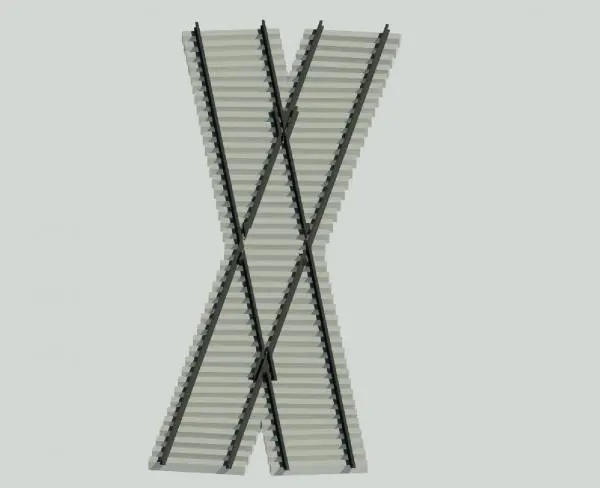
This Railway Crossing Turnout Revit family represents a complex track intersection component, featuring steel rails set on concrete sleepers. The model depicts a standard double-track railway crossing turnout, featuring two intersecting rail paths. It consists of dark steel rails mounted onto a series of light grey concrete sleepers. The geometry captures the precise angular intersection required for track switching, showing the crossing frogs and guard rails in detail. The arrangement is symmetrical, reflecting the technical requirements of a rail junction. The component is modelled with clean lines, providing a clear visual representation of the track layout, suitable for site plans and infrastructure design documentation where precise spatial coordination is essential.
The download is a 3.6 MB file containing a Revit family (.rfa). Load it into a project from the Insert tab with Load Family, then place it like any other component of its category; it schedules and tags with the rest of your model.
In Revit, this family functions as a site-based component. Users should place the turnout into the master site model or a dedicated rail infrastructure sub-file. Because of its specific geometry, it is best aligned using reference planes or CAD underlays defining the track centreline. Designers can apply standard material parameters to the rails and sleepers to match project-specific visual requirements. It is recommended to lock the family to the site coordinate system to ensure alignment with existing or proposed track alignments.