Loading page…
Revit Family
Survey Site Tag NEE Annotation
by Saeri Shojima
About this asset
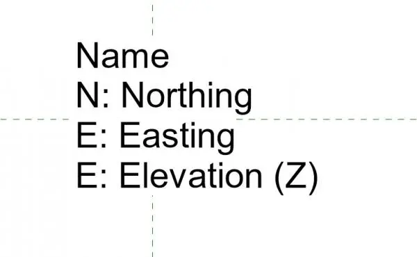
This Revit annotation tag displays Northing, Easting, and Elevation data for site survey documentation in native Revit projects. The Survey Site Tag NEE is a functional annotation family designed for clear, legible representation of coordinate data on site plans. It features a structured layout with specific labels for a survey point name, followed by its corresponding Northing, Easting, and Elevation values. The graphic is minimal, relying on standard text labels and a crosshair reference to ensure precise placement at survey markers. It is built to maintain readability across various scales, ensuring that critical survey information remains clear when exported to documentation sets or printed for field reference during the construction phase.
The download is a 328 KB file containing a Revit family (.rfa). Load it into a project from the Insert tab with Load Family, then place it like any other component of its category; it schedules and tags with the rest of your model.
Load this tag family directly into your Revit project as a generic annotation. Once inserted into a plan view, use the label parameters to input or link coordinates to your survey points. The family is designed to be placed over survey control points, where it will automatically align with your project's coordinate system. Ensure your project units are correctly configured to match the survey data inputs for accurate reporting of site levels and geographic positions.
This annotation is essential for architects and civil engineers preparing site plans, topographic surveys, and master planning documentation. It is used throughout the design and construction documentation phases to communicate precise site levels and coordinate data to contractors and surveyors. When paired with site massing or topography, it provides the necessary technical clarity for setting out building footprints. Professionals typically search for this asset when needing to standardise site documentation, coordinate reporting, or when generating detailed survey information for planning applications.