Loading page…
HDRI / Environment
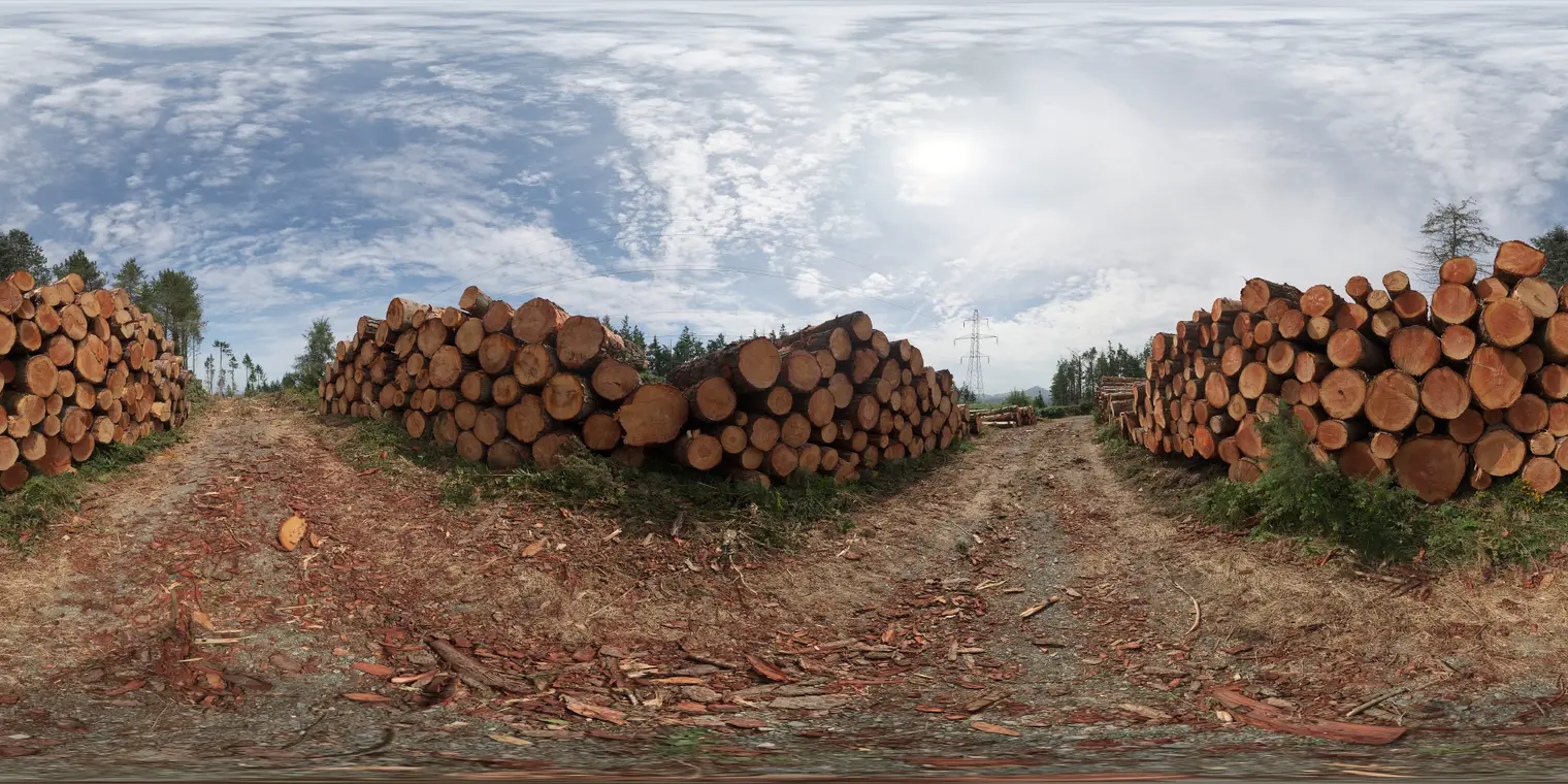
Forestry Log Stack HDRI Environment Map
by Zachary Teixeira
About this asset
This equirectangular HDRI environment map provides realistic midday forestry lighting with high-contrast shadows for outdoor scenes. The environment map captures a rural forestry clearing featuring large, stacked timber logs lining a dirt track. The lighting conditions represent a clear to partly cloudy midday sky, producing bright, directional sunlight and distinct, high-contrast shadows. The composition offers a 360-degree panoramic view, including the textures of rough-hewn bark, exposed wood grain, and the surrounding forest vegetation. The ground plane consists of compacted dirt and scattered wood debris, providing a naturalistic base for lighting and reflection calculations in architectural and landscape visualisation projects requiring an authentic, unrefined outdoor atmosphere.
The download is a 6.6 MB file containing a 2K equirectangular high-dynamic-range environment map, ready to load as dome or world lighting in Blender, 3ds Max, SketchUp renderers, Unreal Engine and D5.
To implement this HDRI, load the file into the environment slot of your rendering engine's world lighting settings. Adjust the exposure and rotation parameters to align the primary light source with your scene's intended sun position. Because this is an equirectangular map, it will automatically map to the spherical projection of your virtual sky, ensuring consistent global illumination, realistic ambient occlusion, and accurate specular reflections on all materials within your 3D environment, especially those with high-gloss or metallic properties.