Loading page…
HDRI / Environment
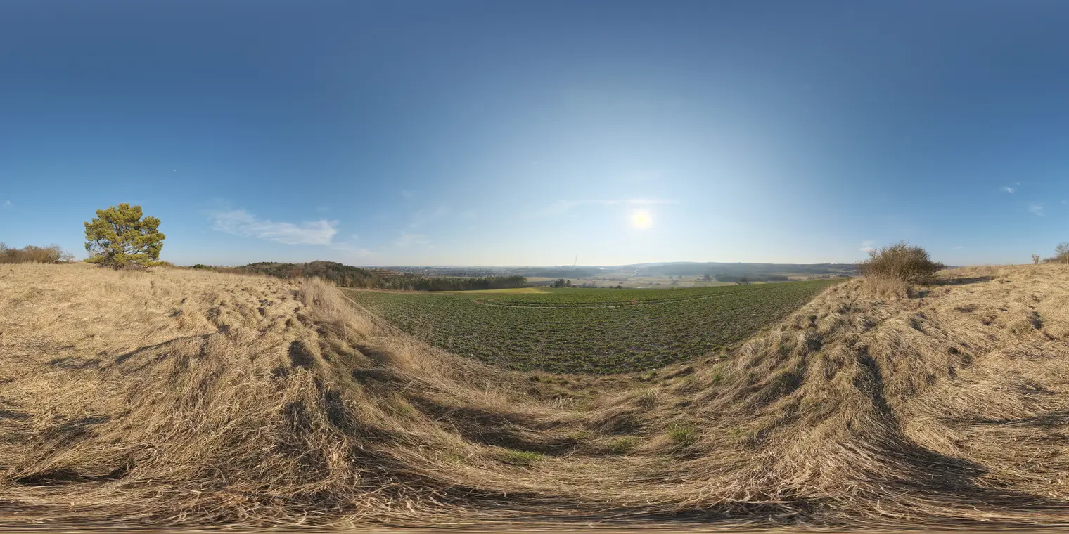
Ehingen Hillside 2 HDRI Environment Map
by Viviana Wang
About this asset
This equirectangular HDRI environment map provides realistic natural daylight for 3D scenes, featuring a clear sky over a rural hillside. The environment map captures a high-latitude perspective of a grassy hillside, characterized by dry, golden-brown grasses in the foreground and a vibrant green cultivated field in the mid-ground. A solitary tree stands on the left slope, adding depth to the open composition. The sky is a deep, clear blue, suggesting a bright midday sun position that provides strong, directional light and distinct shadows. The overall aesthetic is natural and expansive, suitable for wide-angle exterior architectural visualizations requiring authentic, unclipped lighting conditions that integrate seamlessly with ground-plane geometry in any rendering engine.
The download is a 6 MB file containing a 2K equirectangular high-dynamic-range environment map, ready to load as dome or world lighting in Blender, 3ds Max, SketchUp renderers, Unreal Engine and D5.
To utilize this HDRI, load the file into the environment slot of your rendering software, such as V-Ray, Corona, or Octane. Ensure the mapping is set to spherical or environment mode to correctly project the panorama. Because this map contains high dynamic range data, it will automatically drive global illumination and shadow intensity based on the visible sun position. Use the rotation parameters within your software to align the sun with your project's primary light sources for consistent shadow casting across all 3D assets.