Loading page…
CAD Drawing
Barges and Scows Set of 10
by Dennis Schiaroli
About this asset
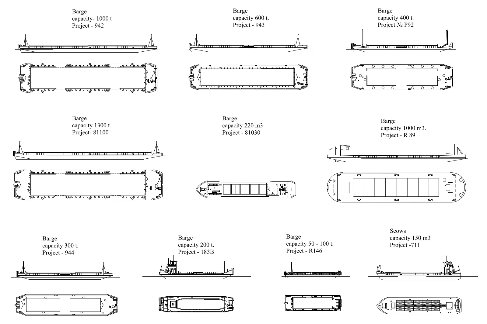
This collection of ten barges and scows provides detailed 2D CAD drawings in AutoCAD format, showing plan and elevation views. This set features ten distinct maritime vessels, including various barges and a scow, presented as precise 2D technical drawings. Each entry displays a top-down plan view paired with a corresponding side elevation. The vessels vary significantly in size, hull configuration, and deck layout, reflecting their specific tonnage or cubic meter capacities. Drawn with clean, single-weight lines, these silhouettes provide essential geometric data for site planning and maritime infrastructure projects. The drawings are clearly labelled with project identifiers and capacity specifications, ensuring they remain useful for technical documentation and accurate site context representation.
The download is a 287 KB file containing an AutoCAD drawing (.dwg) drawn in plan and elevation holding 10 separate objects. It opens in AutoCAD, BricsCAD, DraftSight and other DWG-compatible CAD programs, ready to insert as blocks into plans and elevations.
These AutoCAD drawings are designed for direct insertion into master planning or civil engineering files. Users can easily scale these blocks to match project-specific dimensions or use them as reliable underlays for site analysis. Since the geometry is provided as 2D linework, it remains lightweight and efficient within larger site plans. You can simply copy and paste these into your current working file or attach them as external references to maintain a clean and organised drawing structure.