Loading page…
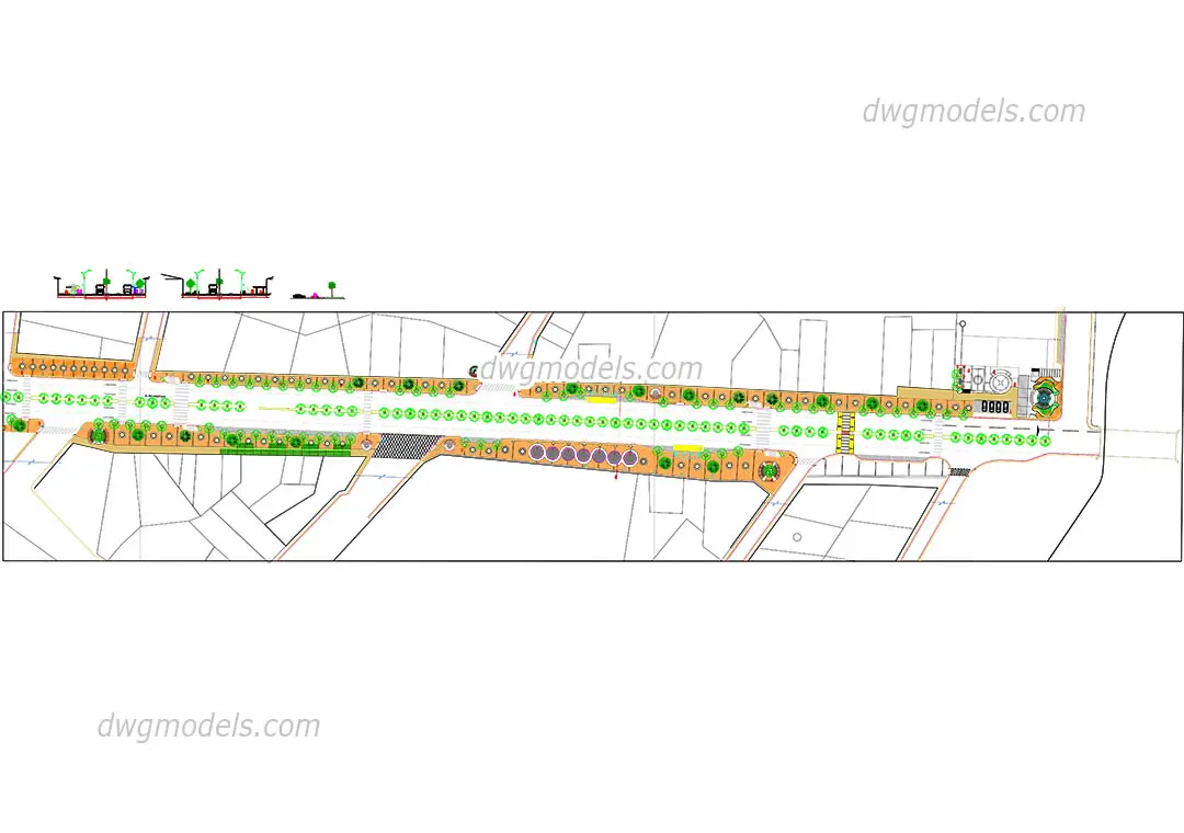
CAD Drawing
Urban Streetscape Plan and Section Layout
by Megan Dang
About this asset
Comprehensive AutoCAD streetscape drawing featuring a detailed site plan with integrated cross-sections for urban planning projects. This technical drawing provides a complete layout for a multi-lane street, including detailed site planning and representative cross-sections. The plan view encompasses road geometry, pedestrian walkways, and organized vegetation placements, while the accompanying sections illustrate the vertical relationship between the street surface, curbs, and surrounding landscape elements. The file is structured to clearly define spatial hierarchies, allowing for precise assessment of traffic flow, pedestrian accessibility, and green infrastructure integration. It serves as a foundational reference for urban development, capturing essential site measurements and environmental features within a standard, clean CAD environment.
The download is a 1.4 MB file containing an AutoCAD drawing (.dwg) drawn in plan and elevation. It opens in AutoCAD, BricsCAD, DraftSight and other DWG-compatible CAD programs, ready to insert as blocks into plans and elevations.
Professionals can integrate this drawing directly into master planning or site development files by using the block insertion or external reference commands. The geometry is organized to facilitate easy scaling and layer management, allowing users to toggle between plan and section views as needed for site analysis or presentation. By leveraging the existing line work, architects can quickly adapt the layout to specific site conditions or develop detailed hardscape and planting schedules for municipal submissions or urban design proposals.