Loading page…
CAD Drawing
Urban Planning Residential Complex Site Plan
by Adriana Hinojosa
About this asset
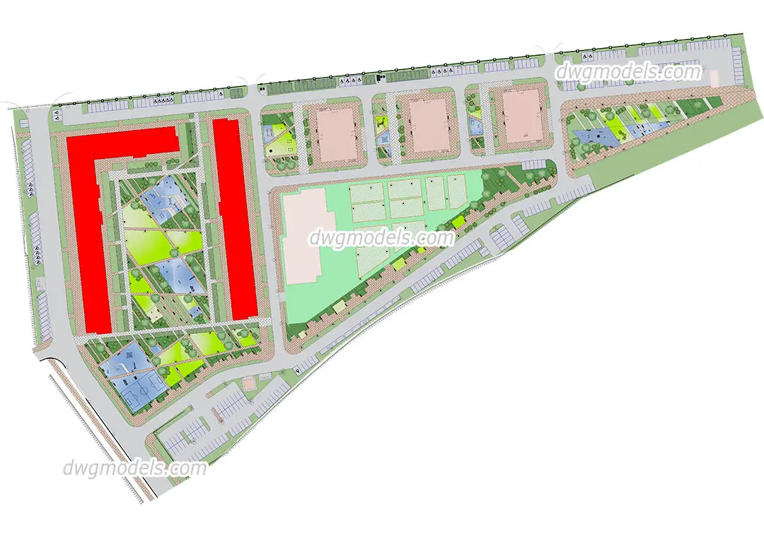
This comprehensive 2D AutoCAD site plan depicts a contemporary residential development, featuring integrated landscaping and parking. The drawing presents a detailed residential urban planning scheme, organised around a central green corridor and structured pedestrian pathways. It includes multiple building footprints, with primary residential blocks highlighted in red, alongside dedicated parking zones, recreational green spaces, and small water features. The layout demonstrates a clear hierarchy of circulation, balancing dense housing units with open communal areas. All elements are represented in a clean, professional vector format suitable for masterplanning documentation, showcasing a cohesive approach to site density, vegetation placement, and vehicular access routes within a defined triangular plot boundary.
The download is a 2.6 MB file containing an AutoCAD drawing (.dwg) drawn in plan. It opens in AutoCAD, BricsCAD, DraftSight and other DWG-compatible CAD programs, ready to insert as blocks into plans and elevations.
Professionals can utilise this DWG file as a foundational reference for early-stage site analysis or as a base for developing more detailed landscape and architectural masterplans. The geometry is organised into logical layers, allowing for easy selection, modification, or isolation of specific site elements like paving, planting, or building footprints. Users can scale the drawing to match specific site dimensions, adjust line weights for presentation quality, or reference it into larger project files to maintain consistent urban context.