Loading page…
CAD Drawing
Public Park Monument Elevation Drawing
by Brett Riegler
About this asset
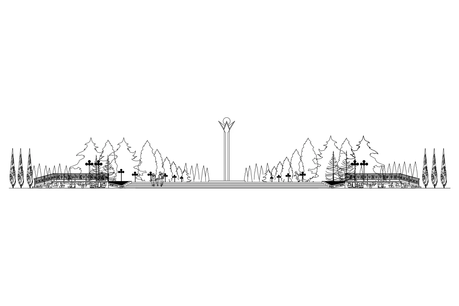
This professional AutoCAD DWG drawing illustrates a public park elevation, featuring a central monument, mature trees, and lighting. The drawing presents a formal elevation of a public park space, centred on a prominent vertical monument. The composition integrates a structured landscape design, incorporating rows of conical trees, dense woodland silhouettes, and low-level shrubbery. Flanking the central axis are raised terraced platforms with decorative railings, providing a sense of depth and hierarchy. Street lighting fixtures are positioned throughout the space, suggesting a well-planned environment suitable for evening use. The linework is clean and precise, capturing the scale of the built elements against the organic forms of the vegetation, providing a clear visual representation for design documentation.
The download is a 215 KB file containing an AutoCAD drawing (.dwg) drawn in elevation. It opens in AutoCAD, BricsCAD, DraftSight and other DWG-compatible CAD programs, ready to insert as blocks into plans and elevations.
Professionals can incorporate this DWG file directly into larger site plans or master planning documents in AutoCAD. The geometry is organised to allow for easy scaling to match specific project site dimensions. Users can manipulate individual layers to adjust the level of detail, such as toggling tree symbols or lighting fixtures on and off, ensuring the drawing integrates seamlessly into existing presentation sets or technical construction document packages without requiring extensive cleanup or re-drawing of the complex landscape elements.