Loading page…
CAD Drawing
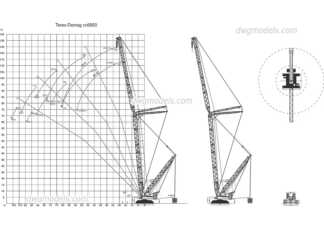
Terex-Demag CC6800 Crawler Crane Technical Drawing
by Vipasha Thorat
About this asset
This AutoCAD DWG technical drawing of the Terex-Demag CC6800 crawler crane provides precise elevation and plan views for site logistics. This technical CAD documentation illustrates the Terex-Demag CC6800 crawler crane in high-fidelity 2D line work. The file includes detailed side elevations showing the lattice boom configuration, hook block, and base assembly. A top-down plan view is provided, demonstrating the machine's operational radius and footprint. The drawing is overlaid with a coordinate grid and critical performance curves, mapping out reach and lifting capacities at various boom angles. These vector lines are clean and well-structured, offering an accurate representation of this heavy-duty crane's geometry for professional site analysis and logistical planning.
The download is a 1.4 MB file containing an AutoCAD drawing (.dwg) drawn in all views. It opens in AutoCAD, BricsCAD, DraftSight and other DWG-compatible CAD programs, ready to insert as blocks into plans and elevations.
Engineers and site planners can import this DWG file directly into AutoCAD or other CAD-compatible software as a reference block. The geometry is fully scalable, allowing users to adjust the crane's position within a wider site plan. Because the file is structured as clean vector linework, it integrates seamlessly into existing construction documentation, site logistics layouts, or lifting studies. Users should verify that the drawing units match the project coordinate system before scaling the crane to fit specific site conditions.