Loading page…
CAD Drawing
Metro Station Infrastructure Technical CAD Drawing Set
by Rodrigo Araujo Toca
About this asset
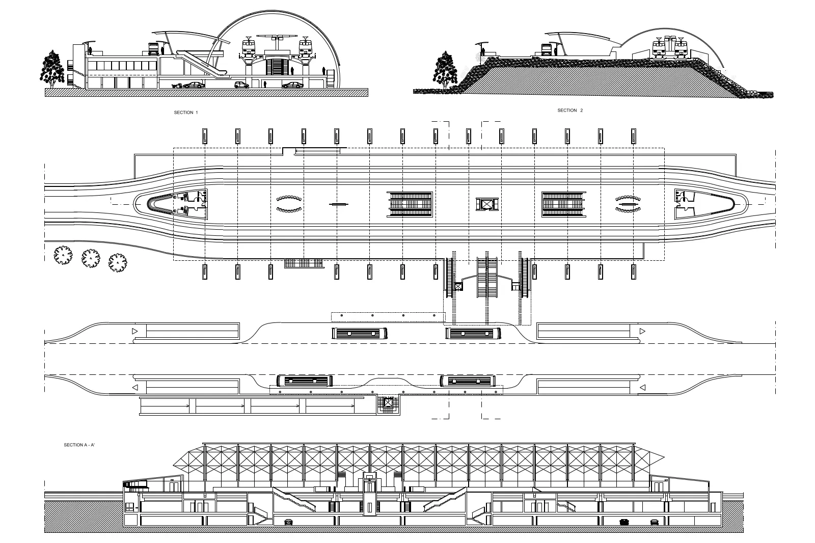
Comprehensive metro station infrastructure CAD drawing set in AutoCAD format, featuring detailed structural sections and site plans. This technical CAD drawing set provides a detailed overview of a modern metro station facility. It includes comprehensive site layouts, platform configurations, and structural sections. The design highlights a large-span steel truss roof system, integrated bus transit interchanges, and multi-level pedestrian circulation paths. The drawings illustrate clear spatial relationships between the platform levels, ticketing zones, and external boarding areas. Precision linework defines the structural elements, including reinforced concrete foundations, station canopy profiles, and vertical circulation shafts such as escalators and stairs. This set acts as a foundational reference for transit-oriented development projects and large-scale public infrastructure planning.
The download is a 829 KB file containing an AutoCAD drawing (.dwg) drawn in all views. It opens in AutoCAD, BricsCAD, DraftSight and other DWG-compatible CAD programs, ready to insert as blocks into plans and elevations.
Professional users can import this DWG file directly into AutoCAD or compatible CAD software to serve as a base for infrastructure design. The geometry is organised for efficient layering, allowing architects to toggle between structural, circulation, and site-specific layers for clear documentation. Designers can reference these layouts to establish primary spatial constraints or scale components within their own site master plans, ensuring accurate alignment with standard public transit dimensions and structural requirements during the preliminary design phase.