Loading page…
CAD Drawing
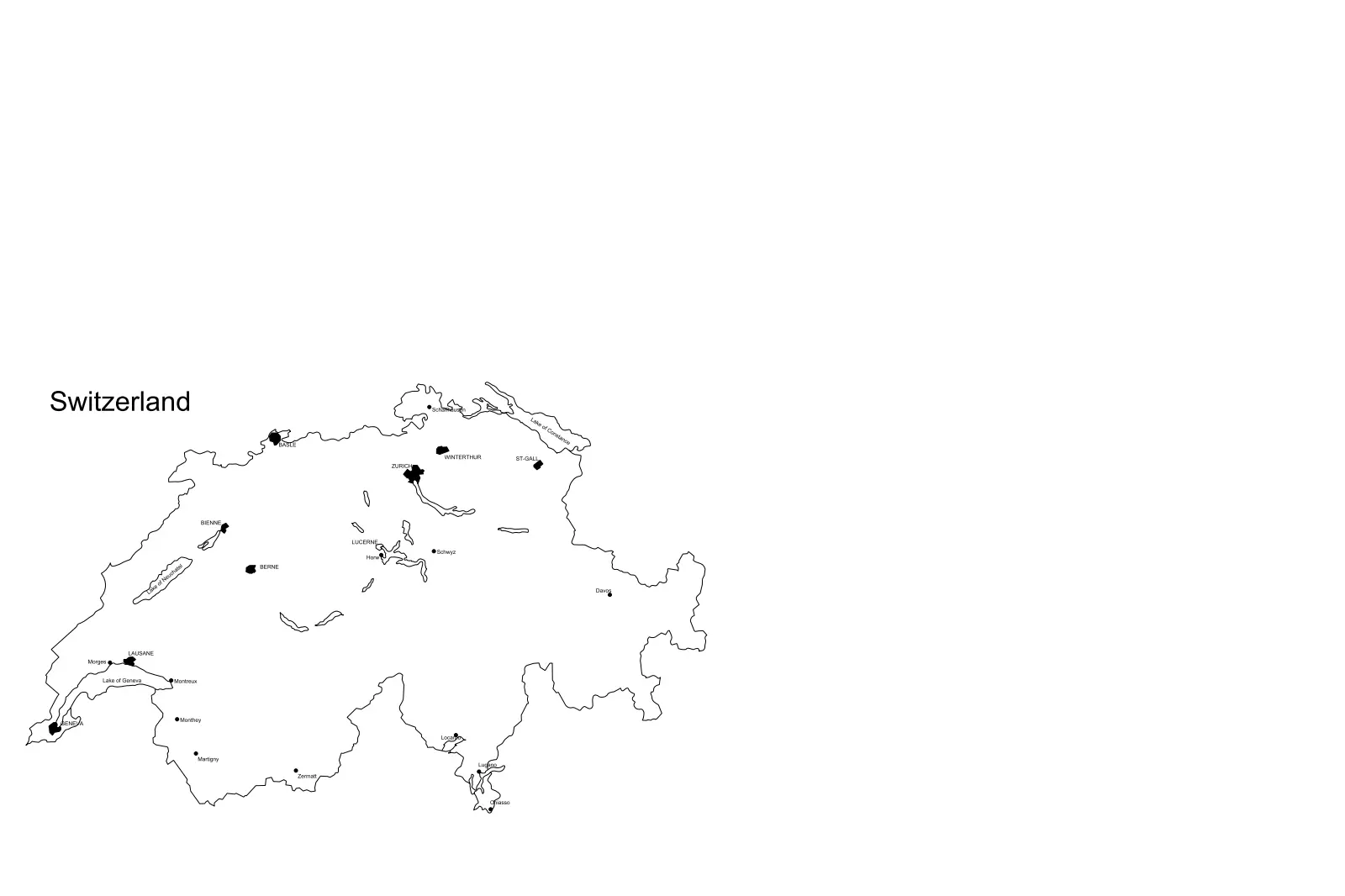
Switzerland National Map CAD Drawing
by Wanlapa Koosakul
About this asset
This Switzerland national map CAD drawing for AutoCAD features clean vector linework of the country border, major lakes, and cities. Presented as a clear, two-dimensional line drawing, this map of Switzerland provides a simplified vector representation of the national boundary. It includes key geographic landmarks such as major inland lakes and identifies significant urban centres with labelled points. The geometry is clean and lightweight, designed for straightforward integration into architectural site plans, master planning documentation, or presentation layouts. Every line is constructed as standard CAD entity, ensuring that the file remains easy to edit, scale, or modify to suit specific project requirements without introducing complex, unnecessary data overhead.
The download is a 133 KB file containing an AutoCAD drawing (.dwg) drawn in plan. It opens in AutoCAD, BricsCAD, DraftSight and other DWG-compatible CAD programs, ready to insert as blocks into plans and elevations.
Professionals can insert this DWG file directly into their master site plan or project layout as a block or external reference. Because the geometry consists of standard lines and text objects, it is fully scalable to match the coordinate system of any existing drawing. Users should check the units upon insertion to ensure the map aligns correctly with the project scale, and can then adjust line weights or layers to maintain visual consistency with their existing title block and documentation standards.
This asset is intended for architects, urban planners, and consultants working on projects requiring regional context or location mapping within Switzerland. It serves as an ideal base for site analysis, project location diagrams, or regional strategy reports in master planning and infrastructure development. The file is particularly useful for adding clear, readable geographic context to proposal documents or presentation boards where a minimalist, diagrammatic representation of the country is required for quick visual orientation in a wider professional context.