Loading page…
CAD Drawing
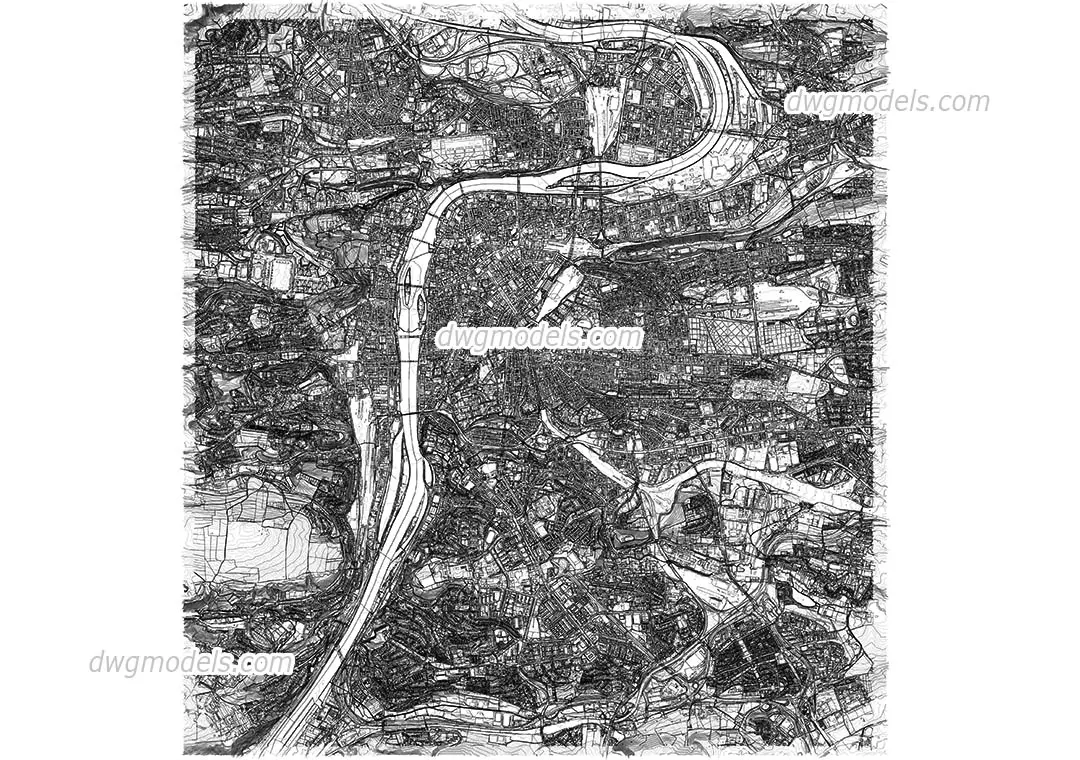
Prague City Topographic Contour Map
by irem iscan
About this asset
This comprehensive 2D topographic map of Prague in DWG format provides detailed contour lines and urban street layouts for planning. Representing the complex urban fabric and natural topography of Prague, this 2D CAD file serves as a foundational base for site analysis. The drawing captures the Vltava River corridor, major arterial road networks, and dense historical city blocks. Fine-line contour data is integrated with street-level geometry, offering a high degree of precision for large-scale architectural or urban planning projects. It provides a clear, high-contrast visual representation of the city's terrain and built environment, making it an essential reference for establishing project context, site boundaries, and regional connections in professional design workflows.
The download is a 49 MB file containing an AutoCAD drawing (.dwg) drawn in plan. It opens in AutoCAD, BricsCAD, DraftSight and other DWG-compatible CAD programs, ready to insert as blocks into plans and elevations.
Professionals can insert this DWG file as an external reference into an AutoCAD project to serve as an accurate base for site development. By placing the file on a locked layer, designers can trace existing street patterns or overlay new building footprints while maintaining coordinate integrity. The vector data allows for easy scaling and snapping, ensuring that site-specific interventions remain aligned with the existing topography and urban infrastructure captured in the drawing.
This map is ideal for urban designers, landscape architects, and civil engineers working on projects within the Prague metropolitan area. It is frequently employed during the preliminary design and feasibility stages to conduct site analysis, assess regional connectivity, and model topographical constraints. Architects use this data to establish the context for large-scale developments, while planners rely on it to study city density and infrastructure patterns. Search for this asset when needing precise geodata for master-planning, site studies, or context-heavy architectural presentations.