Loading page…
CAD Drawing
Prague City Centre Urban CAD Map
by Zhaomei Zheng
About this asset
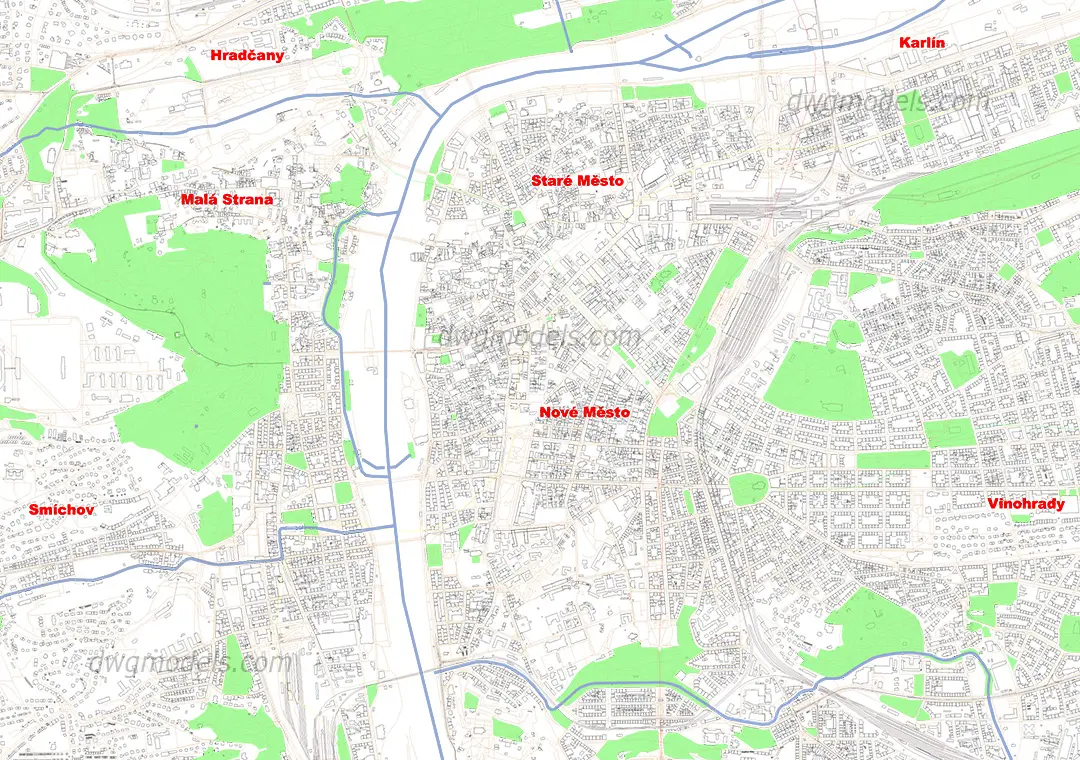
Prague city centre urban CAD map in AutoCAD DWG format, featuring detailed vector linework for site context and planning analysis. This technical CAD drawing provides a comprehensive two-dimensional plan view of Prague's central districts, including Staré Město, Nové Město, Malá Strana, and surrounding areas. The geometry captures essential urban features such as street layouts, block footprints, and green spaces, rendered with clear, scalable vector lines. It serves as a foundational base for architects and urban planners to overlay new developments or perform site analysis. The file is structured to allow for easy layer management, enabling users to isolate specific data points like topography, road networks, or building footprints for precise project integration.
The download is a 25.5 MB file containing an AutoCAD drawing (.dwg) drawn in plan. It opens in AutoCAD, BricsCAD, DraftSight and other DWG-compatible CAD programs, ready to insert as blocks into plans and elevations.
Professionals should import this DWG file directly into their AutoCAD workspace to establish a reliable site context for new design proposals. By utilising the layer structure, users can efficiently toggle off unnecessary data or adjust line weights to maintain clarity in their master plans. It is recommended to verify the coordinate system upon insertion to ensure the geometry aligns accurately with local survey data, facilitating seamless coordination across multi-disciplinary project teams during the early design stages.