Loading page…
CAD Drawing
International National Flag Symbols Set
by Katie Johnson
About this asset
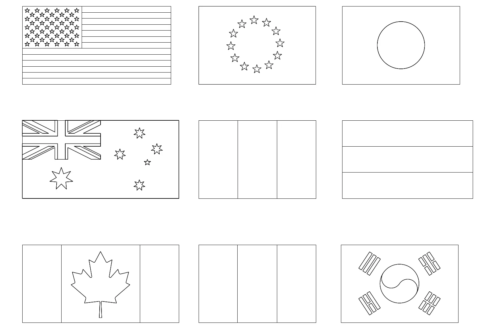
This set of nine national and regional flag symbols is provided as an AutoCAD DWG drawing, featuring clean 2D line-work geometry. This collection includes nine distinct international and regional flags rendered in simple, high-contrast vector line-work. The set comprises the United States, European Union, Japan, Australia, Canada, South Korea, and three tricolour-style flag representations. Each symbol is drafted with clear, closed polylines, ensuring precise scaling and clean reproduction at any plot size. The designs focus on the primary geometric characteristics of each flag, such as the maple leaf, stars, and central circles, stripped of colour fills to maintain a professional, technical aesthetic suitable for architectural presentation or master planning documentation.
The download is a 154 KB file containing an AutoCAD drawing (.dwg) drawn in plan holding 9 separate objects. It opens in AutoCAD, BricsCAD, DraftSight and other DWG-compatible CAD programs, ready to insert as blocks into plans and elevations.
Users can insert this DWG file directly into active projects as a block or copy and paste individual symbols into their current drawing environment. The geometry is composed of standard CAD lines and polylines, allowing for easy adjustment of line weights or scaling to match specific drawing requirements. These symbols are ideal for site plans, wayfinding diagrams, or international project context maps where clear, legible graphic indicators are required for quick site identification or visual interest.