Loading page…
CAD Drawing
Urban Street Section and Plan Drawing
by Emre Ozdemir
About this asset
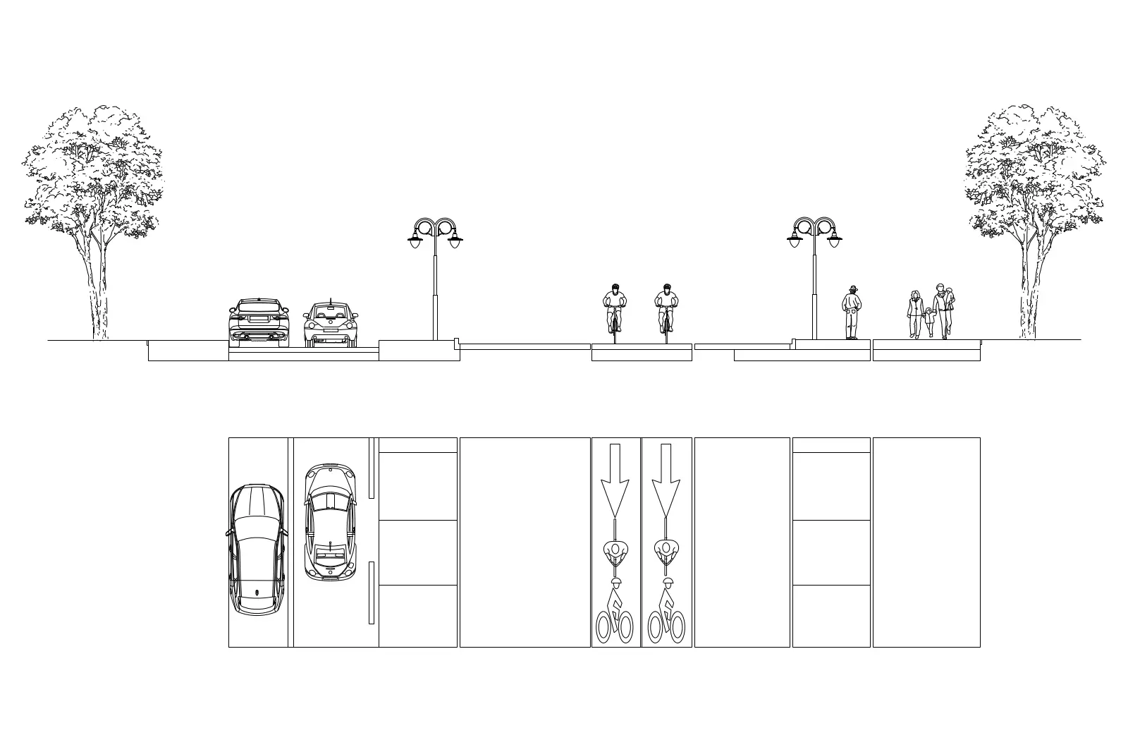
This 2D AutoCAD drawing provides a comprehensive street section and plan view, featuring integrated cycle lanes, parking, and vegetation. The drawing illustrates a balanced urban street profile, detailing a cross-section alongside a corresponding plan view. It incorporates dedicated parking bays, a clear two-way cycle lane marked with directional arrows, and pedestrian zones. The section highlights the vertical relationships between the road surface, kerbs, and street lighting, while the plan view defines the spatial layout for traffic flow and cycling infrastructure. Trees are included as elevation silhouettes to provide scale and indicate planting zones. The linework is clean and structured, suitable for technical documentation in urban development projects.
The download is a 266 KB file containing an AutoCAD drawing (.dwg) drawn in plan and elevation. It opens in AutoCAD, BricsCAD, DraftSight and other DWG-compatible CAD programs, ready to insert as blocks into plans and elevations.
Architects and urban planners can integrate this DWG file directly into master planning documentation or site development files. The geometry is organised for easy scaling and modification to match specific project site dimensions. Users should verify the layer structure upon insertion to ensure compatibility with existing CAD templates. This file serves as a foundational reference for road layout planning, allowing for the quick addition of specific paving patterns, street furniture, or signage to suit local regulatory requirements and design standards.