Loading page…
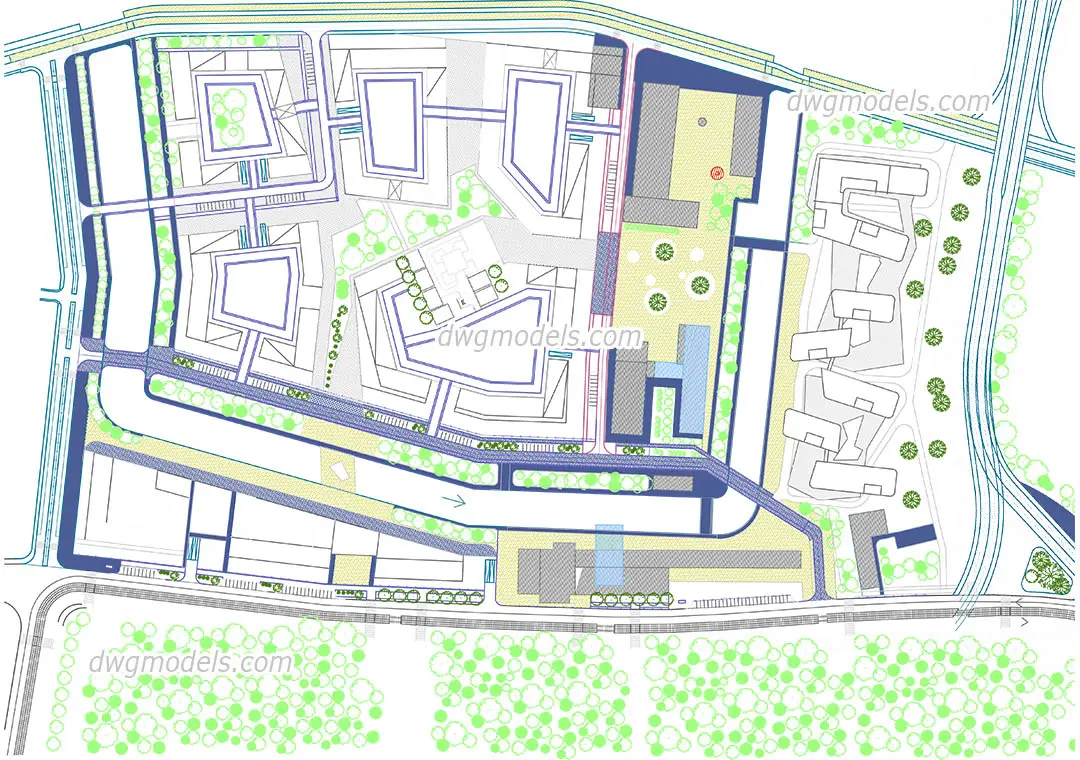
CAD Drawing
Urban Planning Masterplan Layout Drawing
by Patrick Wyszynski
About this asset
This comprehensive urban planning masterplan layout, provided as a professional AutoCAD DWG, details a complex residential site. This masterplan layout illustrates a high-density urban residential development, featuring a mix of geometric building footprints, landscaped public spaces, and defined circulation paths. The drawing includes delineated road networks, pedestrian walkways, and green zones, providing a clear spatial organisation of the plot. The composition is rendered with distinct line weights and colour-coded zones that differentiate between residential blocks, communal plazas, and infrastructure elements. It serves as a foundational reference for site analysis, zoning validation, or conceptual development, offering a structured framework for architects and urban designers to build upon during the initial project phases.
The download is a 1.3 MB file containing an AutoCAD drawing (.dwg) drawn in plan. It opens in AutoCAD, BricsCAD, DraftSight and other DWG-compatible CAD programs, ready to insert as blocks into plans and elevations.
Professionals can integrate this drawing directly into active AutoCAD projects by referencing it as an external file or importing the geometry into a master site plan. The layers should be reviewed upon insertion to ensure compatibility with existing project standards, particularly for line types and annotation styles. Users may choose to scale the geometry to match specific site surveys or use it as an underlay for developing more detailed landscape designs, street furniture placement, or utility coordination plans within the drafting environment.