Loading page…
CAD Drawing
Underground Parking Layout Plan
by TZUYI LEI
About this asset
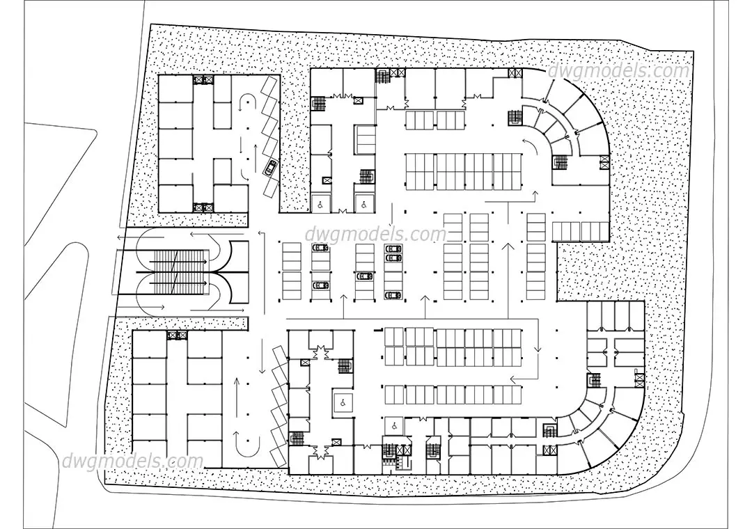
This AutoCAD DWG drawing provides a detailed plan view of an underground parking facility with defined circulation and bays. The drawing presents a comprehensive layout for an underground parking level, featuring a structured arrangement of standard and accessible parking bays. It includes clearly defined circulation routes, vehicular flow arrows, and access points for vertical circulation, such as stairwells and lift cores. The geometry is clean and precise, focusing on the functionality of space allocation and traffic management within a subterranean footprint. The plan captures the relationship between structural columns, parking stall dimensions, and the surrounding site boundary, providing a foundational template for large-scale parking design and site planning documentation.
The download is a 819 KB file containing an AutoCAD drawing (.dwg) drawn in plan. It opens in AutoCAD, BricsCAD, DraftSight and other DWG-compatible CAD programs, ready to insert as blocks into plans and elevations.
Professionals can integrate this DWG file directly into AutoCAD or other CAD-compatible software by using the XREF command for site planning or as a base layer for further design development. The geometry is organised, allowing users to easily adjust bay configurations, add annotation, or modify circulation paths to suit specific project requirements. It is recommended to verify the drawing units and scale upon insertion to ensure compatibility with existing site plans and master layouts for precise coordination.