Loading page…
CAD Drawing
Roadway Cross-Section AutoCAD Drawing Set
by Uriel Quevedo
About this asset
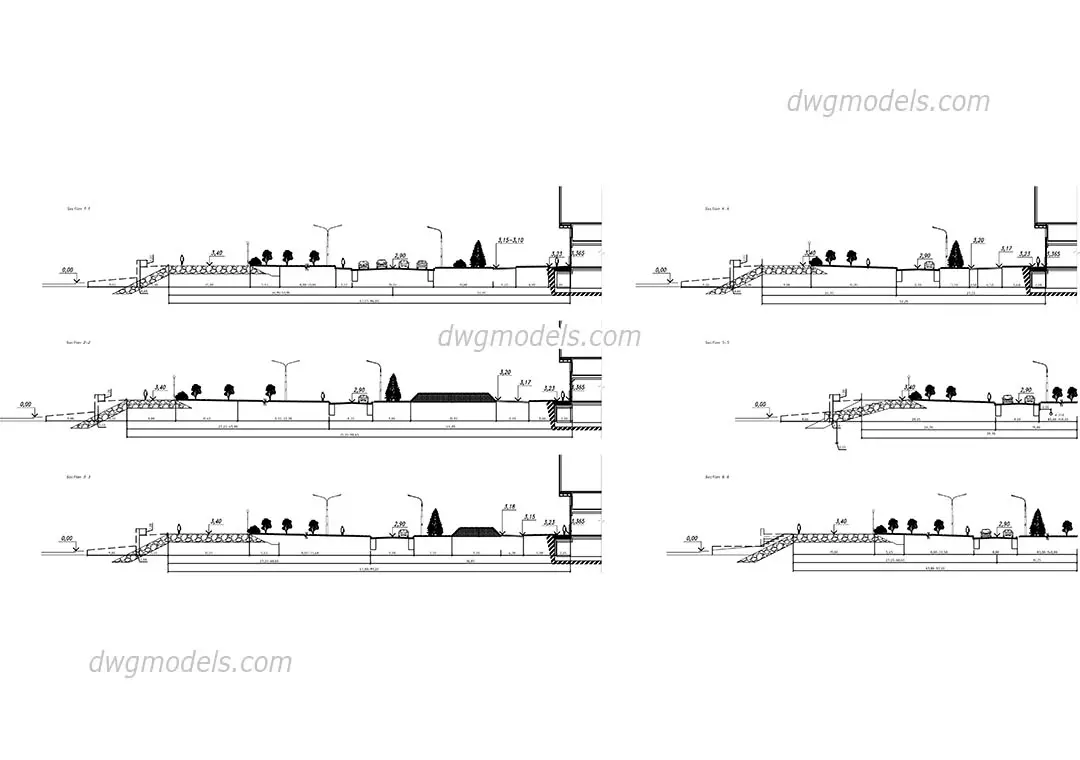
This AutoCAD DWG drawing set provides six detailed roadway cross-sections illustrating urban street profiles and embankments. This technical drawing set contains six variations of roadway cross-sections, each detailing the interface between a waterfront embankment, pedestrian pathways, vehicular lanes, and adjacent building foundations. The sections display standard civil engineering conventions, including graded slopes, retaining structures, street lighting placement, and vegetation markers. Each profile is presented as a clean, line-based CAD drawing with clear elevation markers and dimensional indicators. These sections represent a typical urban streetscape configuration, capturing the relationship between public infrastructure and private development, suitable for integration into larger master planning or site development documentation packages.
The download is a 2.8 MB file containing an AutoCAD drawing (.dwg) drawn in section. It opens in AutoCAD, BricsCAD, DraftSight and other DWG-compatible CAD programs, ready to insert as blocks into plans and elevations.
These CAD drawings are provided in DWG format, allowing for direct insertion into existing project files as blocks or external references. Professionals can easily modify the line weights, adjust the layering system to match internal CAD standards, or scale the geometry to fit specific site surveys. The vector-based nature of the content ensures that individual components, such as street lamps or vegetation symbols, can be extracted and reused as standard detail components across different urban design projects.