Loading page…
CAD Drawing
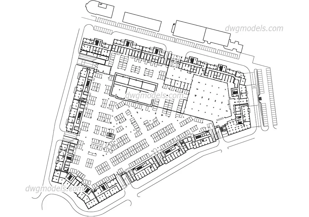
Underground Parking Complex AutoCAD Site Plan
by Sophiya Khan
About this asset
Detailed AutoCAD site plan of an underground parking complex, featuring comprehensive structural layouts and vehicular circulation. This professional CAD drawing presents a high-level site plan for a large-scale underground parking facility. The layout delineates complex circulation paths, parking stall arrangements, and structural grid alignments throughout the subterranean level. It includes peripheral building footprints, service cores, access ramps, and pedestrian entry points, providing a clear overview of the site's spatial organisation. The drawing is structured with clear line weights and standard architectural symbology, making it suitable for early-stage masterplanning or technical feasibility studies. The geometry remains clean and organised, allowing for efficient integration into larger site development files.
The download is a 901 KB file containing an AutoCAD drawing (.dwg) drawn in plan. It opens in AutoCAD, BricsCAD, DraftSight and other DWG-compatible CAD programs, ready to insert as blocks into plans and elevations.
Architects can utilise this file as a base for site analysis or as a reference for developing parking layouts in AutoCAD. The geometry is provided in a standard 2D format, enabling users to easily manipulate blocks, adjust circulation lanes, or overlay additional site data. Professionals should verify the drawing units and layer structure upon insertion to ensure compatibility with existing project files, then use it as an XREF to maintain a clean working environment during the design process.