Loading page…
CAD Drawing
The Bent Pyramid Archaeological Site Plan and Section
by Roger Ferney Cortés
About this asset
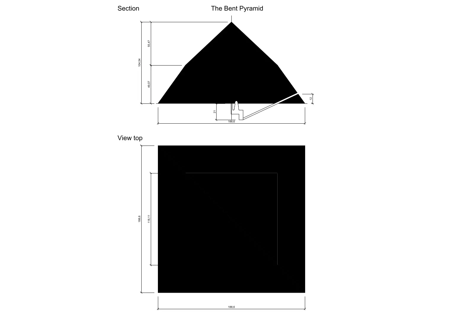
The Bent Pyramid CAD drawing provides a precise plan and section for architectural documentation in AutoCAD featuring site dimensions. This technical drawing illustrates the iconic geometry of the Bent Pyramid, depicting its distinct dual-slope elevation and square plan footprint. The file includes detailed linear annotations indicating the structural height and base dimensions, essential for understanding the unique profile of this historic monument. The section view highlights the internal slope change at the mid-section, while the top view clarifies the square base geometry. It is presented as clean, high-contrast vector linework, allowing for clear legibility when scaled or integrated into broader site plans, master planning documents, or historical research projects requiring accurate archaeological data.
The download is a 92 KB file containing an AutoCAD drawing (.dwg) drawn in plan and elevation. It opens in AutoCAD, BricsCAD, DraftSight and other DWG-compatible CAD programs, ready to insert as blocks into plans and elevations.
Architects and researchers can import this DWG file directly into AutoCAD or any compatible CAD software as a reference for site analysis or historical modelling. The geometry consists of standard lines and polylines, which are fully editable and scalable to match the specific units of your project file. Use the provided dimensions to verify the scale against your master site plan, ensuring alignment with existing topographical surveys or surrounding landscape features in your current drafting environment.