Loading page…
CAD Drawing
World Map Geographic Outline Drawing
by Jeremiah Hadi
About this asset
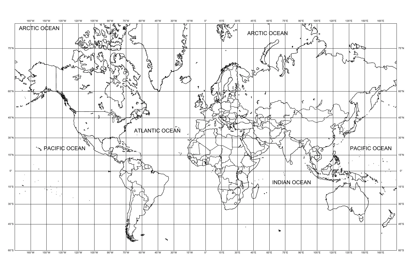
This clean, vector-based world map drawing for AutoCAD provides a precise geographic outline with latitude and longitude grid lines. Presented as a clear, two-dimensional line drawing, this world map features standard continental outlines and major ocean labels. The composition is structured by a consistent grid of latitude and longitude coordinates, ranging from 165 degrees West to 165 degrees East. Coastlines are rendered with simple, continuous line weights, ensuring legibility at various scales. The geometry is clean and stripped of extraneous data, focusing purely on the primary landmass shapes. It serves as an essential base layer for site analysis, global logistics planning, or as a decorative graphic element in architectural presentations.
The download is a 1004 KB file containing an AutoCAD drawing (.dwg) drawn in plan. It opens in AutoCAD, BricsCAD, DraftSight and other DWG-compatible CAD programs, ready to insert as blocks into plans and elevations.
As a standard DWG file, this asset integrates directly into AutoCAD projects via the Insert command or as an externally referenced file. The vector geometry allows for seamless scaling to fit specific title blocks or presentation boards without loss of clarity. Users can easily manipulate line weights, adjust layer properties, or overlay additional project-specific data such as site locations or regional nodes. The file is optimised for clean plotting and can be exported to other software platforms for further graphic refinement.
This map is a versatile resource for architectural and interior design projects requiring global context. It is frequently employed in lobby displays, corporate office branding, or educational facility layouts to illustrate global reach or project locations. Designers often incorporate these outlines into master planning documents, proposal covers, or site analysis diagrams where a simplified world view is necessary. It pairs well with minimalist interiors and professional presentation templates, providing a neutral, informative backdrop for communicating international scope or logistics in commercial, hospitality, or institutional building typologies.