Loading page…
CAD Drawing
Road Signs and Traffic Barriers Malaysia Set
by Xinyi Wang
About this asset
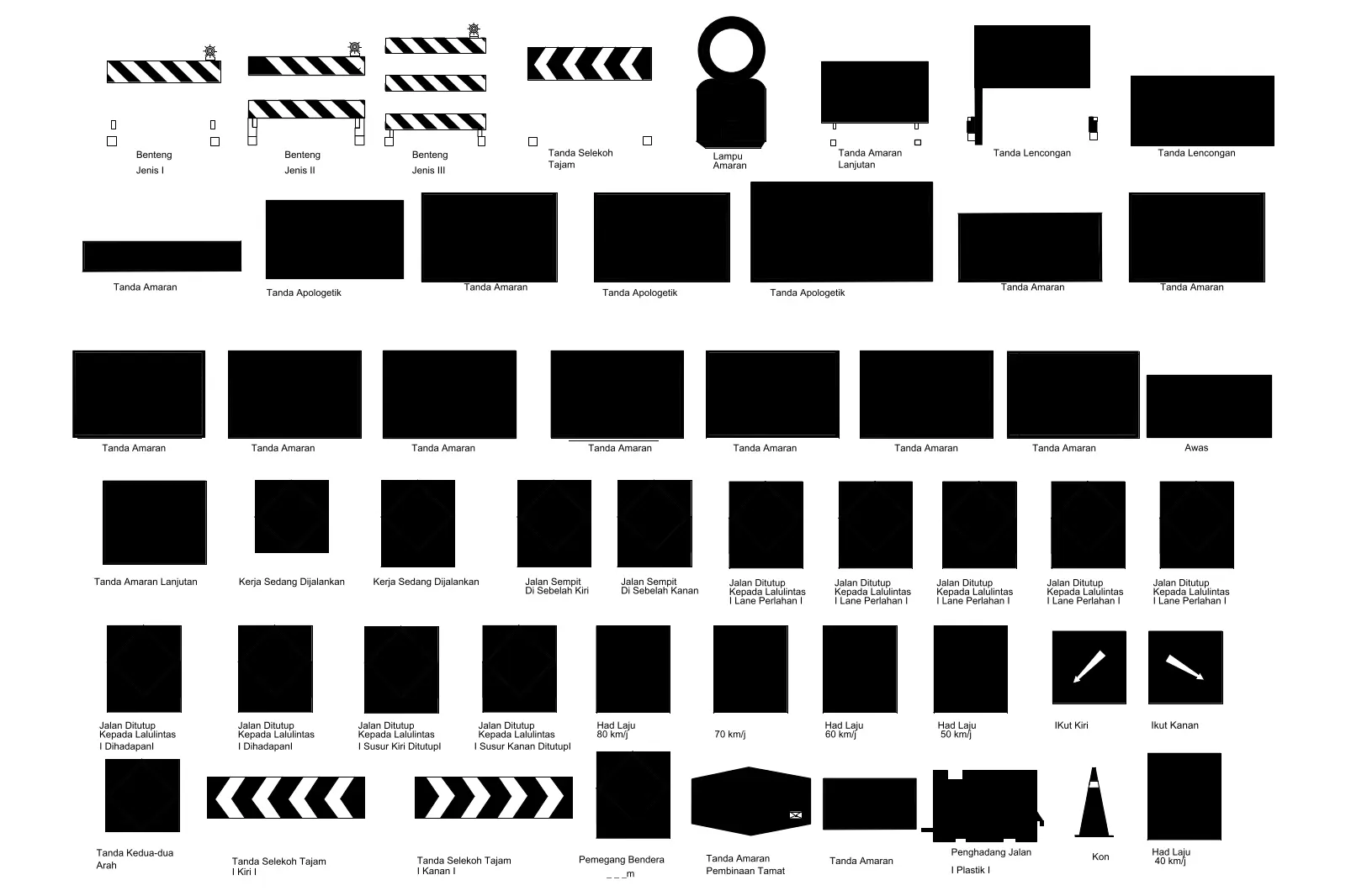
Comprehensive set of Malaysian road signs and traffic barriers in AutoCAD DWG format for site planning and infrastructure layouts. This collection comprises fifty-five distinct 2D vector symbols representing standard Malaysian road signage, traffic barriers, and safety equipment. The set includes various warning signs, speed limit indicators, directional arrows, and temporary roadwork markers. Each symbol is drafted in a clean, black-and-white silhouette style suitable for site plans and civil engineering documentation. The collection features essential traffic management elements such as bollards, traffic cones, and rigid barriers, all scaled for consistent placement within professional technical drawings. The geometry is straightforward, prioritising clarity and legibility when plotted at standard architectural or civil engineering scales.
The download is a 154 KB file containing an AutoCAD drawing (.dwg) drawn in plan holding 55 separate objects. It opens in AutoCAD, BricsCAD, DraftSight and other DWG-compatible CAD programs, ready to insert as blocks into plans and elevations.
Professional users can insert these symbols directly into AutoCAD as individual blocks or reference the entire DWG file into a master site plan. Since the geometry consists of standard 2D lines and polylines, it is highly efficient and will not impact drawing performance. Designers can easily scale these blocks to match specific plot scales or layer them into existing site furniture categories to maintain organised drawing standards across large-scale infrastructure projects.