Loading page…
3D Scene
Urban Masterplan District Scene
by Ishrat Muktadir
About this asset
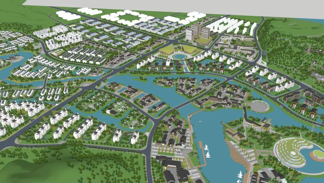
This comprehensive SketchUp model provides a large-scale urban masterplan featuring integrated residential zones, water features, and green space. The scene illustrates a complex urban masterplan, meticulously laid out with a variety of residential typologies ranging from detached housing clusters to medium-rise apartment blocks. The central design incorporates extensive water channels and lakes that weave through the residential areas, creating a distinctive waterfront character. Pedestrian-friendly pathways, landscaped green belts, and public plazas are distributed throughout the site, providing connectivity between the different sectors. The topography is gently varied, with structured vegetation and tree planting defining the boundaries and communal areas. This model captures the overall density, spatial relationships, and site circulation of a contemporary mixed-use development.
The download is a 56.4 MB compressed archive containing the native SketchUp (.skp) model. It opens directly in SketchUp; for 3ds Max, Blender or Cinema 4D, import it through a SketchUp importer or convert it first.
Users can effectively employ this SketchUp model as a foundational asset for large-scale site analysis or as a base for further architectural development. The file is structured to allow for easy manipulation of massing and landscape components. Professionals should utilize layers to isolate specific building clusters or site elements, enabling efficient management of the complex geometry. Textures and lighting settings can be adjusted within the native environment or exported to external render engines for more advanced visualization and site-wide environmental simulations.